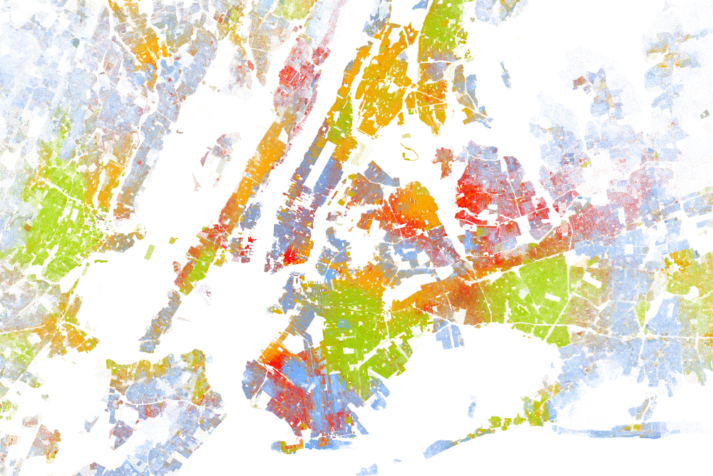
DT Cochrane Wired has published a series of maps that try to visualize racial segregation in many of America’s biggest cities. From Wired: “The [maps], created by Dustin Cable at University of Virginia’s Weldon Cooper Center for Public Service, is stunningly comprehensive. Drawing on data from the 2010 U.S. Census, it shows one dot per […]
Continue Reading
